
Product
-
Weather station
-
Road Weather Station
-
Photovoltaic Inspection
-
Atmospheric monitoring
-
Operating condition monitoring
Recommended article
- The price of meteorological monitoring systems varies from 3,900 to 39,800 yuan depending on the number of monitored elements
- Power Quality Measurement Makes Power Grid Harmonic Detection and Data Logging More Efficient
- High-Precision Meteorological observation equipment Aids Field Environmental Monitoring
- How Forest Weather Station Improves Forest Fire Risk Early Warning Capabilities Through Real-Time Data Acquisition
- The Electrical Power Analyzer's four-channel synchronous measurement capability enhances the efficiency of photovoltaic grid-connected testing
- How Ultrasonic Snow Depth Monitoring Stations Achieve Accurate Snow Depth Measurement
Contact us
Shandong Fengtu IOT Technology Co., Ltd
Sales Manager:Ms. Emily Wang
Cel,Whatsapp,Wechat:+86 15898932201
Email:info@fengtutec.com
Add:No. 155 Optoelectronic Industry Accelerator, Gaoxin District, Weifang, Shandong, China
GNSS Monitoring Stations: Ensuring Slope Stability and Enabling Early Landslide Warning
Article source:Weather station time:2025-11-12 09:44:33 viewed:663times
Slopes, as common geographical features in engineering construction and natural environments, are widely distributed along highways and railways, mining areas, around water conservancy projects, and in urban and town hillside areas. Instability of slopes, triggering disasters such as landslides and collapses, directly threatens people's lives and property safety, causing significant losses like traffic interruptions and engineering damage. Therefore, establishing a precise and efficient slope early warning system is crucial. Timely recording of minor slope deformations and early prediction of disaster risks can buy valuable time for emergency response, minimizing the impact of disasters. This is the core significance of slope monitoring work.
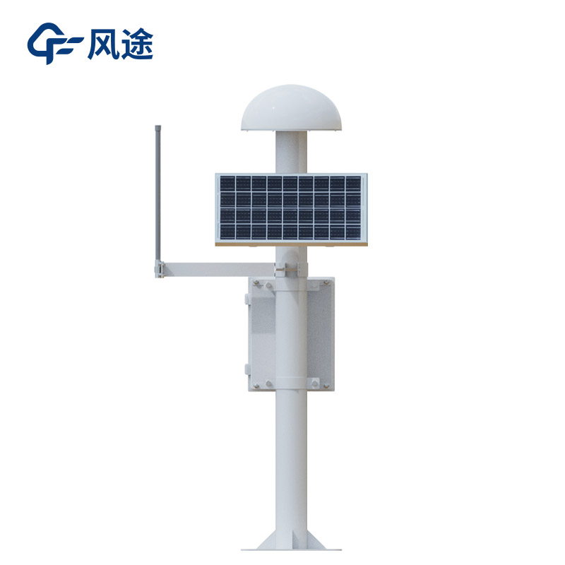
The Fengtu® GNSS Monitoring Station, as a core device in the field of slope monitoring, utilizes the advantages of satellite positioning technology to provide comprehensive protection for slope safety. Its working principle is based on the Global Navigation Satellite System (GNSS). By deploying monitoring stations at key positions on the slope, it receives positioning signals from multiple satellites in real-time to accurately calculate the three-dimensional coordinates of the monitoring points. Compared with traditional monitoring methods, the GNSS Monitoring Station does not require close proximity to the slope, can operate continuously under complex terrain and harsh weather conditions, and is unaffected by factors such as light and visibility, enabling 24/7 uninterrupted monitoring.
Before slope instability occurs, very small displacement deformations often happen, which might be only at the millimeter level—undetectable by manual observation. However, the positioning accuracy of the GNSS monitoring station can reach the millimeter level, allowing it to detect the earliest subtle changes in the slope. The displacement information is uploaded in real-time to the monitoring platform via a data transmission system. By analyzing the data trends, monitoring personnel can assess the stability state of the slope. When the displacement exceeds a preset threshold, the system automatically issues an early warning signal, alerting relevant units to take emergency measures such as reinforcement or personnel evacuation.
The GNSS monitoring station requires no manual inspection, is unaffected by weather or day/night cycles, and enables fully automated data collection and transmission. This significantly reduces labor costs and avoids human error. More importantly, the continuous monitoring data can construct a complete historical curve of slope deformation. This holds irreplaceable research value for analyzing the evolution patterns of landslides, evaluating the effectiveness of control projects, and conducting medium to long-term stability predictions.
This paper addresses:https://www.fengtuweather.com/industry/834.html
Related products
Related article
-
What Weather Station Models Are Worth Recommending?
2025-03-04 -
Prairie Weather Stations Promote Data Sharing
2024-05-08 -
Visibility Monitoring station in Modern Traffic Meteorological Systems: Functions, Data Transmission and Traffic Accident Reduction
2025-08-27 -
Which IoT devices are suitable for weather stations?
2024-03-13 -
FT-SW2: An River Level Monitoring Station
2025-11-06 -
Miniature weather station Integrated Meteorological and Air Quality Monitoring System is suitable for field deployment
2026-02-02 -
Forest fire weather station, intelligent fire prevention
2024-03-20 -
Geological Disaster Monitoring Systems by Fengtu Technology
2025-09-08