
Product
-
Weather station
-
Road Weather Station
-
Photovoltaic Inspection
-
Atmospheric monitoring
-
Operating condition monitoring
Recommended article
- The price of meteorological monitoring systems varies from 3,900 to 39,800 yuan depending on the number of monitored elements
- Power Quality Measurement Makes Power Grid Harmonic Detection and Data Logging More Efficient
- High-Precision Meteorological observation equipment Aids Field Environmental Monitoring
- How Forest Weather Station Improves Forest Fire Risk Early Warning Capabilities Through Real-Time Data Acquisition
- The Electrical Power Analyzer's four-channel synchronous measurement capability enhances the efficiency of photovoltaic grid-connected testing
- How Ultrasonic Snow Depth Monitoring Stations Achieve Accurate Snow Depth Measurement
Contact us
Shandong Fengtu IOT Technology Co., Ltd
Sales Manager:Ms. Emily Wang
Cel,Whatsapp,Wechat:+86 15898932201
Email:info@fengtutec.com
Add:No. 155 Optoelectronic Industry Accelerator, Gaoxin District, Weifang, Shandong, China
Snow depth monitor
Model:FT-XS2
Brand:fengtu
 Get a Free Quote
Related products
1.Snow depth monitor product introduction
Snow depth monitor is a highly accurate and reliable snow monitoring device designed to measure the depth of snow on the ground.XS2 Snow depth monitor uses laser recognition and measurement technology to overcome the disadvantages of ultrasonic waves, electromagnetic waves, weight and other types of sensors that cannot be recognized by snow, thereby achieving extremely high detection accuracy.By monitoring the distance at the location, the thickness of the snow is obtained and the snowfall per unit time is analyzed.This device can be an independent automatic snow depth monitoring alarm system, or it can be networked to form a diversified network monitoring.
Application scope: Widely used in many fields such as meteorological stations, port terminal safety monitoring, road traffic safety monitoring, aviation monitoring, building safety monitoring, agricultural production monitoring, hydrology and water conservancy.
Measurement principle: The snow depth sensor uses the principle of a phase laser rangefinder to measure the depth of snow.The phase is the frequency of the radio band, which uses the amplitude modulation of the laser beam and determines the phase delay generated by the modulated light to travel to the measurement line once, and then converts the distance represented by this phase delay according to the wavelength of the modulated light.That is, the time required for light to pass through the round-trip measurement line is determined by indirect method, thereby solving the depth of snow.
2.Product features of Snow depth monitor
1.Low-power collector: static power consumption is less than 1mA
2.Standard GPRS networking, support extended Bluetooth and wired transmission
3.Android 7-inch touch screen, version: 4.4.2, Quad-core Cortex™-A7, 512M/4G
4.Support modbus485 sensor expansion
5.Solar charging management MPPT automatic power point tracking
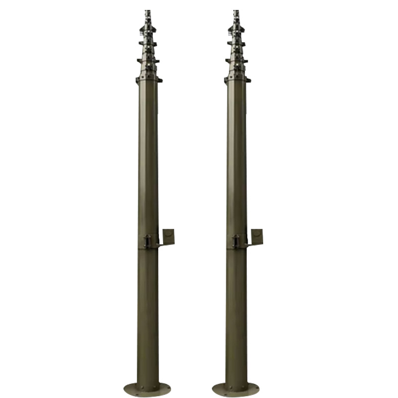
6.Three-meter carbon steel bracket, two sections connected
7.SMS alarm, send SMS to the specified mobile phone after exceeding the limit
8.Stainless steel protective box, corrosion-resistant and oxidation-resistant, waterproof grade IP66
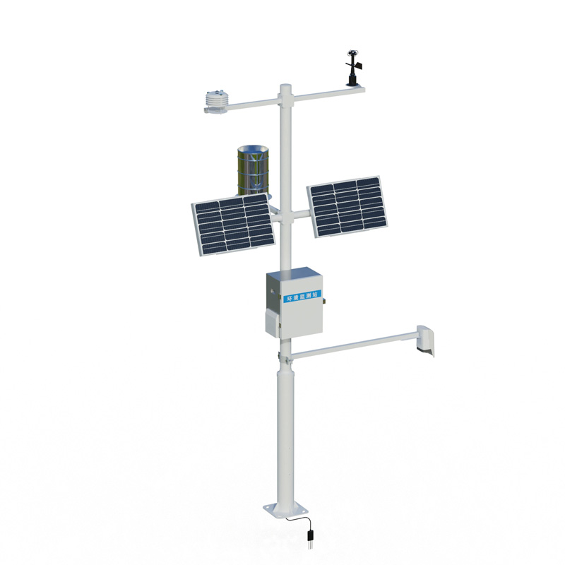
3.Snow depth monitor system composition
Laser snow depth sensor, host, pole bracket, solar power supply system, cloud platform
4.Snow depth monitor technical parameters
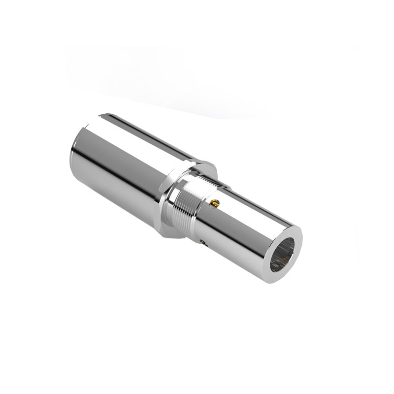
1.Collector power supply interface: GX-12-4P, input voltage 8-16V, with RS485 output json data format
2.Sensor modbus, 485 interface: GX-12-4P plug, output power supply voltage 12V/1A, device configuration interface: GX-12-4P plug, input voltage 5V
3.Solar power supply and equipped with lead-acid battery, optional 30W 20AH/50W 40AH/100W 100AH.Charging controller: 150W, MPPT automatic power point tracking, efficiency is increased by 20%.
4.Data upload interval: 30s-65535s adjustable
5.7-inch Android touch screen, screen size: 1024*600 RGB LCD (optional)
6.Sensor technical parameters
| name | Measurement range | Resolution | Accuracy |
| Laser snow depth | 0.05~3m | 1mm | ±1.0mm |
| Ambient temperature | -40~+80℃ | 0.01℃ | ±0.3℃ (25℃) |
| Relative humidity | 0~100%RH | 0.01%RH | ±3%RH (20%~80%) |
| Light intensity | 0-157286LUX | 1Lux | <±3% |
| Atmospheric pressure | 300-1100hpa | 0.1hPa | ±0.25% |
| Dew point temperature | 0~+70℃ | 0.1℃ | ±1℃ |
| Soil temperature | -30~+70℃ | 0.01℃ | ±0.3 (-10~70℃) |
| Soil moisture | 0~100% | 0.1% | ±3% |
| Soil Salt | 0~20000us/cm | 1us/cm | ±3 (0~10000us/cm) ±5% (full range) |
| Soil PH | 0-14PH | 0.01 | ±0.1PH |
| wind direction | 0-360 degrees | 0.1 degree | ±1 degree |
| Wind speed | 0-60m/s | 0.01m/s | ±0.2m/s |
| Average wind speed☆ | 0-60m/s | 0.01m/s | ±0.2m/s |
| rainfall | ≦4mm/min | 0.2mm | ≤±2% |
| Ultraviolet radiation | 0~500W/㎡ | 0.01W/㎡ | ≤±3% |
| Sunshine hours | 0~6500h | 0.1h | <0.2h |
| Total photoelectric radiation | 0-2000W/m2 | 1W/m2 | <±3% |
| Photosynthetic effective radiation | 0-2000W/m2 | 1W/m2 | ≤±5% |
| PM2.5 | 0-1000ug/m³ | 1ug/m³ | ±10% (<500 micrograms) |
| PM10 | 0-1000ug/m³ | 1ug/m³ | ±10% (<500 micrograms) |
| Carbon monoxide | 0-1000ppm | 1PPM | ±2PPM |
| Sulfur dioxide | 0-20PPM | 0.1PPM | ±1PPM |
| Nitrogen dioxide | 0-20PPM | 0.1PPM | ±1PPM |
| ozone | 0-20PPM | 0.1PPM | ±1PPM |
| Negative oxygen ions | 0~100,000 units/cm3 | 1/cm3 | Reading ±10%; ion mobility ≤±20% |
| Oxygen content | 0~25%Vol | 0.1% | ±3%FS |
| carbon dioxide | 400-5000ppm | 1PPM | ±(50ppm+5% reading value) |
| Evaporation | 0-190mm | 0.01mm | ±1% |
7.The manufacturer has a computer software registration certificate
8.The manufacturer is a 3A credit enterprise
9.Manufacturers have ISO quality management system, environmental management system and occupational health management system certification
5.Introduction to Snow depth monitor cloud platform
1.CS architecture software platform, supports direct observation of mobile phones and PC browsers without additional software installation.
2.Support multiple accounts and multiple devices to log in
3.Support real-time data display and historical data display dashboard
4.Cloud server and cloud data storage are stable and reliable, easy to scale, and load balancing.
5.Support SMS alarm and threshold settings
6.Support map display and viewing device information.
7.Support data curve analysis
8.Support data export table form
9.Supports data forwarding, HJ-212 protocol, TCP forwarding, http protocol, etc.
10.Support data post-processing function
11.Support external running of javascript scripts
Related article
-
Advantages of Negative Oxygen Ion Monitoring Stations
2024-03-12 -
Construction Site Dust and Noise: Problems, Solutions and Monitoring
2025-04-10 -
Selection of Meteorological Monitoring Equipment for Highways and Its Functions
2024-11-13 -
Mastering Road Conditions with Road Weather Station
2025-01-09 -
Complete solution for small-scale weather stations Provides Customized Miniature Weather Station Hardware and Software System Services
2025-12-11 -
Scenic Weather Station: Empowering Negative Oxygen Ion Marketing in Tourist Attractions
2025-07-01 -
Fengtu Technology's Visibility Detection Systems: Enhancing Traffic Safety on Highways
2025-10-20 -
Scenic anion monitors are a highlight of scenic publicity!
2024-03-26